Lower Starletta Viewscapes
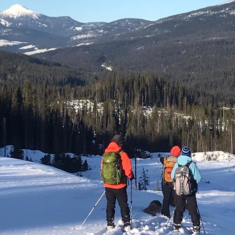
This is one of the cutest and most view intensive ski/walks you can do. Everywhere on this trip are views and reveals that make the trip special. In less than a ½ hour you can be enjoying a panaromic mountain view and you can spend the whole day exploring the endless possibilities of Valley Mountain.
I had previously mentioned that if you cross the street from the Yellowhawk parking lot you can angle northward over the side of the road and head up the meadows to Wendle Lake. However, if you go directly across the street you will see flagging tied in a tree that guides you directly into a little forest grove, before emerging onto a broad meadow. There are two flagged routes to the other side, where you can see an enticing small clearing. If its cold and snowy enough head out 100 metres and cross a shallow wet spot NW-ish back onto dry land. In milder weather(as I write this, in fact), you angle off northwest only 50 m out and hug the south side of a willow patch that will keep you from getting your skis wet. As you regain what is obviously dry ground, in less than 100 m, march over to the forest just 70 m north of the clear patch you can see on the other side of the valley. Here, where the creek is as close as it can possibly get to the edge of the forest, there is a bridge making an easy crossing over a beaver dam. Cross the dam bridge and turn left to the clearing and head up.
From the clearing an open forest leads 100 m to an old mine road(watch for the flagging). Turn right on the road and it goes flat for 50 m before turning right again and heading on a beautiful and low angle uphill traverse. As you rise on a clear road, bits of mountain view poke out and beautiful snow pillows decorate the roadway. Ignore two angled left branches and follow this road to a natural left turn and a short 70 m to what we call ‘The T junction’. You are standing on a magnificent example of hydraulic ditch building(hand-made ditches that delivered water from where it existed to where it was needed(in this case, the Starletta Mine). Here you have two choices: Turn left and angle uphill slightly and then more steeply and travel through a low angle mature, clear forest full of snow ghouls and beautiful stands of trees.
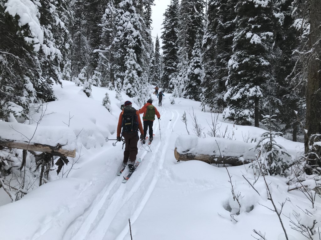
In less than 300 m you will pop out of the forest onto a large logging road that will re-orient you and give you great views of Roundtop Mountain to the south, down by Yanks Peak. From here its a short walk uproad to the first block, cross the road and head upforest on a treasure hunt, or turn left and walk out before you need to! However, if you turn right, back at the T junction in the previous paragraph, you can enjoy a curving level path that brings you to a small creek and the only possibly intimidating part of the trip. Enter the steep hillside, where we have cleared away any obstacle logs and make your way just 60 metres up this hill and pop onto the bottom of the first clearcut at ‘The Exit’. Before you start up though…look down the creek! If the snow is deep, and the weather cold this is a beautiful and exciting exit that brings you back to the valley bottom not far from where you went up, but with a small challenge in finding your way back across Wendle Creek.
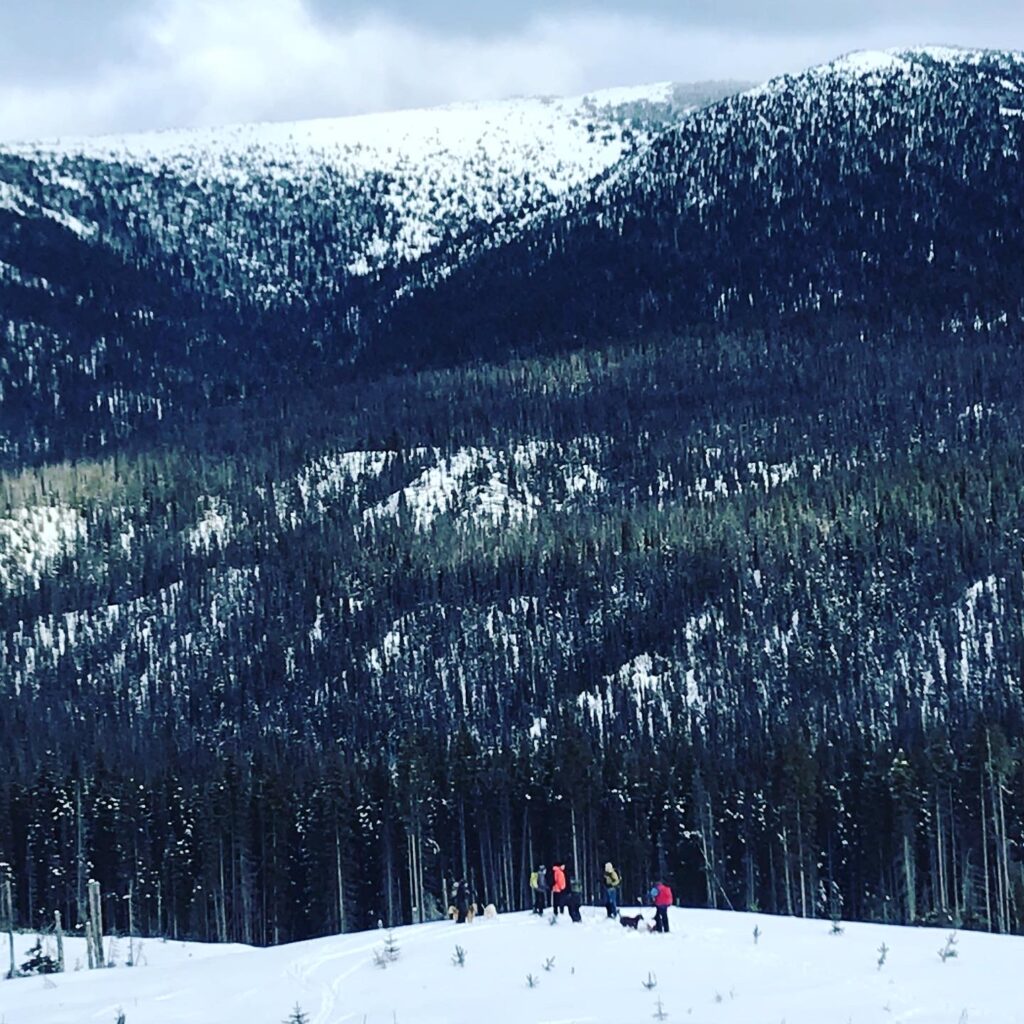
Meanwhile, back up on the clearcut…go where you like. In less than 100 m uphill you will have views of Greenberry, the Hump, Mt. Murray, Slide and Two Sisters Mountains, all at once. That’s it! The simplest possible pretty hike possible. There are km’s of routes from here, and the very erratically placed cutblocks, old mine roads, and sub alpine creekbeds make for incredible skiing variety. Don’t be afraid to explore any of this forest, because it is completely free of blowdown, and consists of mostly open, well spaced travel. Besides circling back on any of the routes I’ve described, you can also head over to the haul road and take the long low-angle trip back to the Starletta Mine. At the winterized placer miner camp you can ski down to the Bowron Road and cross over and jump on the Deep Lead trail system, or ski the mine roads from the mine bench going northward and you will inevitably bump into your uptrack just before it drops onto the meadow and crosses the Beaver Dam bridge with final scenic views of the mountains as you cross the meadow back to your car. What a lucky day you’ve had!
Another time, I’ll help you discover the top of this mountain…or have a look at the mostly updated winter google earth image of this area, and discover it yourself.
If you don’t have a phone app to add to the fun of navigating I suggest you try GAIA. It works great, it’s super simple, very intuitive, and easy to import , track and export files from(so you can see where you went on Google Earth. The free version is simple but rich, it works offline, and it has good topo information but no aerial imagery. KML files import easily, or use this to see what I mean on Google earth, or many other gps apps.
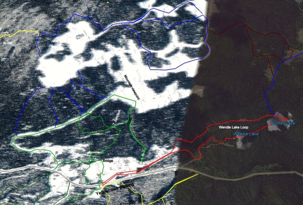
KML for Deep Lead and Starletta: Enjoy this on Google earth, or load it onto your phone. We don’t flag where we think things are obvious, so it’s nice to use this to re-orient yourself if you are wondering where you are, relative to a known route. The great thing about this terrain is that it’s pretty hard to get very lost since the geography always pushes you back to a road.
Labelled Map of the Deep Lead : We haven’t made a map of the Starletta routes as of this moment, but here’s one for the Deep Lead. All of these names are names we made-up to celebrate the many people and events that we’ve taken here.